I have one of those big map atlases that Rand McNally puts out each year, and have begun to use it some to home school my kid in geography. Since the District 11 school she attends is so busy constantly testing kids about the 3 Rs, they don’t seem to have time to teach geography, history, science, nor much really about anything. As it is, if I don’t teach her where Kansas is, she’ll probably be graduating down the road, with the herd of American kids that will be unable to locate their asses from a hole in the ground.
What gets me about Rand McNally is the, shall we say, subtle racism they practice. Where the fuck is Mexico, you idiots? It’s not like Mexicans and Americans don’t drive in each other’s countries. So what happened here? Let’s see? there are detailed maps of Canada’s provinces on 12 pages, plus semi-detailed maps of most of the big cities of that country. But Tijuana? Where is it? Where are the major Mexican cities, the Mexican states? Why might they not be shown? Instead, there is one page with a poorly detailed map of the country of Mexico as a whole. The idea here is a racist one. It is that Mexico is unimportant, and just does not rate being mapped by such a prestigious outfit as Rand McNally. Oh brother. And what idiots!
I wouldn’t mention this map thing, except that it seems so prototypical of the American racist mindset of the world. Dear Mr. McNally Inc., how many Mexicans do you think are in the US as compared to Canadians? When they drive back and forth from the US to Mexico, and Mexico to the US, don’t you think it would be nice of your ‘service’ to provide folks with directions? After all, that is the service your business supposedly is engaged in. Canada gets mapped, so why not Mexico?
Why not provide Texans, for example, with detailed maps of the North of Mexico? It would be nice to have city maps of Monterrey/ Saltillo, Guadalajara, and the DF. And certainly if Newfoundland can get its own detailed provincial mapping, then why not Nuevo Leon, Baja California, Chihuahua, etc.? And why not, other than the racism involved?
This is not just an unthought about error neither. The passage between Tijuana and San Diego is perhaps the busiest international crossing in the world. So why leave a blank space on that map for where Tijuana should be? Duh… Rand McNally is clearly a business that is ready to shoot itself in the foot by totally ignoring Hispanic buyers of their product. Racism seems to be more important to keep intact, than sales of their product or integrity of the service they provide. There are far more people traveling between Mexico and The US, than between the US and Canada, yet Canada gets mapped in detail, while Mexico gets only the barest of outlines of a national map.
The lesson here for my kid, is that neither her Colorado public school nor our big American Rand Mcnally book of maps will educate her well about geography, nor about other cultures. That, she will have to pick up on her own with my help, or she won’t learn much about these things at all. Why? It is simply that we live in a culture that prizes ignorance and stupidity much more than education. America the Free has become America We don’t know Our Asses from a Hole in the Ground. Keep fighting the rot. That’s all we can do.
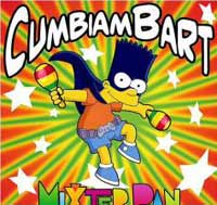 In about 3 weeks we will be in South America! Anybody I tell that I will be taking my 12 year old with me to Colombia looks at me a little weird like??? That being the case I will let Bart Simpson explain just why we are doing what we are doing? Keep in mind, too, that my daughter goes to District 11 Schools Colorado Springs, which is quite a bit like Bart’s school, Springfield Elementary, Jack. Now check out Bart Dances the Cumbia for some real music and dancing!